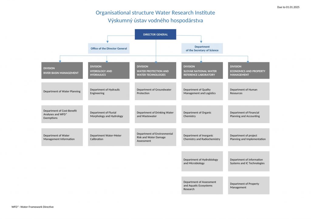
VÚVH is a central scientific research institute with nationwide competence, committed to undertaking applied water management research tasks and to providing comprehensive solutions for water-related ecological issues. The Institute is governed by its statutes that delimit the scope of its activities, and by its organisational regulations that specify the principles and levels of management and its organisational structure. The range of water-related issues addressed by the Institute enables that more broadly-focused interdisciplinary projects can also be undertaken. VÚVH is currently engaged in the following activities:
- scientific research, development, methodological and expert activities in groundwater and surface-water hydrology, river morphology, open-channel flow hydraulics, rehabilitation and restoration of river systems and wetlands, groundwater and surface-water quality monitoring, wastewater and drinking-water treatment technologies;
- transposition of EU legislation into the national laws of Slovakia pertaining to water resources and water management with the aim of ensuring compliance with the requirements laid down in the relevant EU directives and regulations, including their coordination;
- performance of the functions of Slovakia’s National Water Reference Laboratory, in accordance with the applicable legislation;
- ecology and protection of aquatic ecosystems;
- river basin management and planning in water management;
- testing, calibration and verification activities;
- maintenance of an efficient information system in the water management sector;
- professional consultancy, education, publishing and editorial activities.
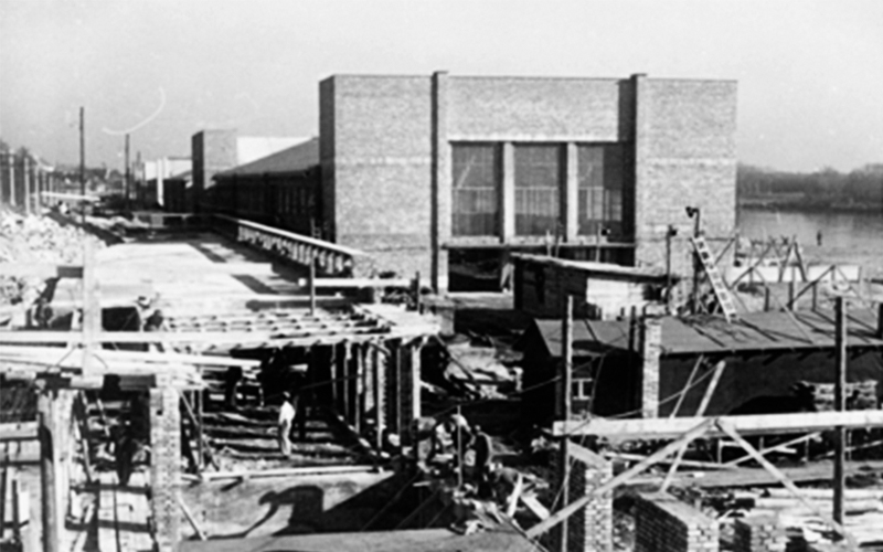
Key components of our Institute are the Hydraulic Laboratory and the National Water Reference Laboratory. Many of the scientific and research activities undertaken by the Institute are unique in Slovakia.
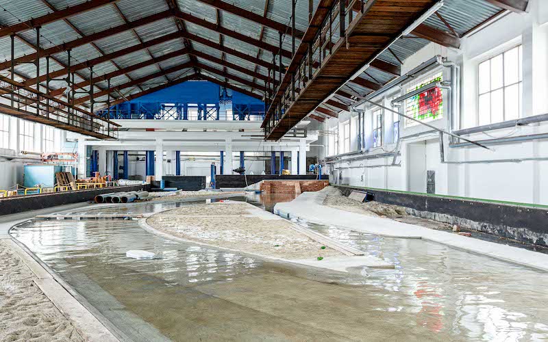
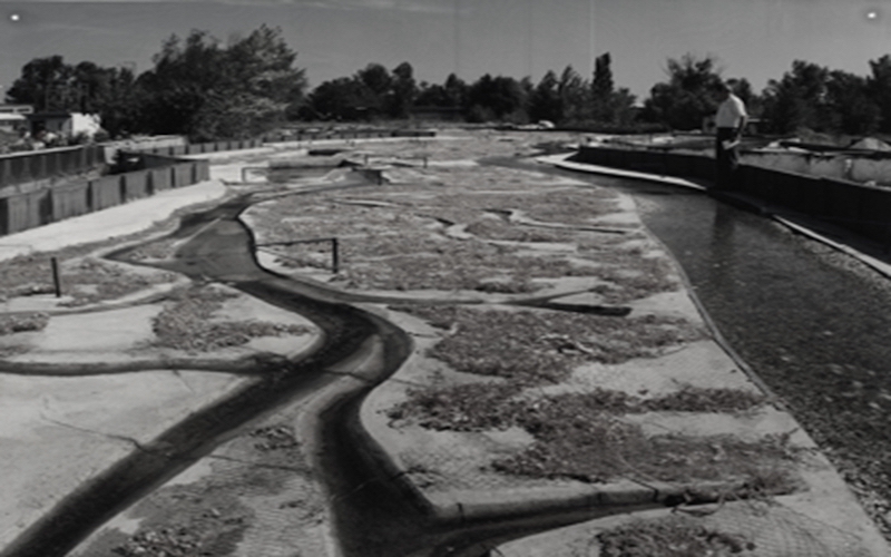
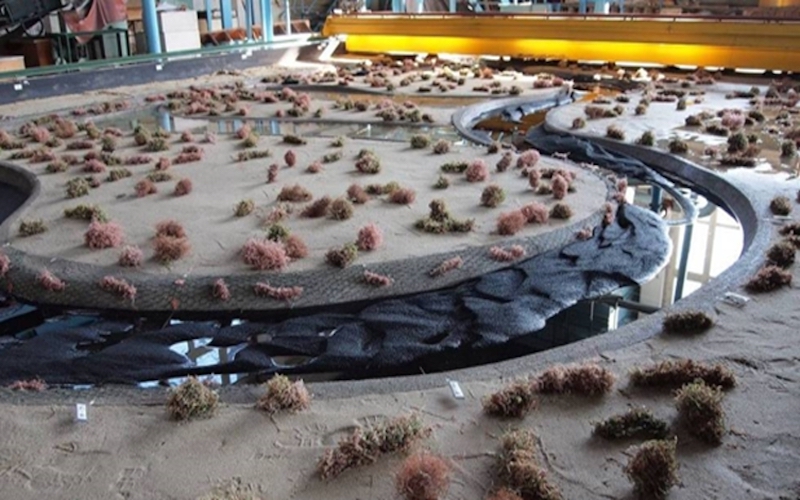
Our Hydraulic Laboratory is unique in Slovakia: it enables applied hydraulic research on river systems and engineering structures by means of medium- and large-scale physical models. The lab has two halls: Hall 1 is 90 m long and 23 m wide (useful area: 12.5 m x 68 m, max. discharge: 600 l/s); Hall 2 is 41 m long and 24 m wide (useful area: 8 m x 20 m, max. discharge: 300 l/s). Hall 1 houses a calibration laboratory for flow meters (including a 68 m long calibrating flume), where accredited and authorised measurements are carried out in accordance with the applicable national legislation and international quality standards.
The Hydraulic Laboratory facilities are used for the study of flow dynamics and sediment transport in river systems. The hydraulic parameters of water engineering structures are determined and their safety is verified on physical models. Flow and sediment transport conditions in rivers are carefully analysed and assessed with the aim of verifying the effectiveness of flood protection, and optimising the scenarios applied and the revitalisation measures proposed.
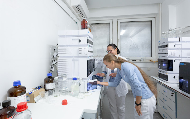
The National Water Reference Laboratory uses the most advanced instruments and procedures to investigate surface-water and groundwater pollution. As a methodological centre, it provides methodological guidance to other water sector organisations. The National Water Reference Laboratory is engaged in the following activities: research into the composition and pollution of various types of water and of the related matrices, evaluation of the research results, and performance of a microbiological analysis of water on the basis of the indicative capabilities of aquatic communities.
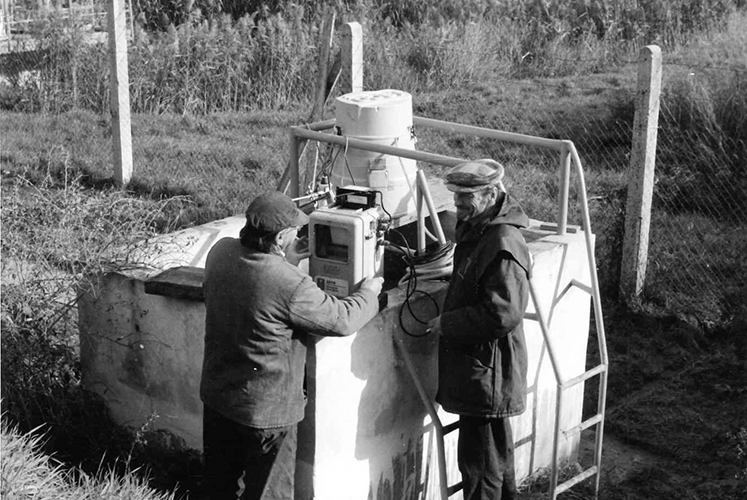
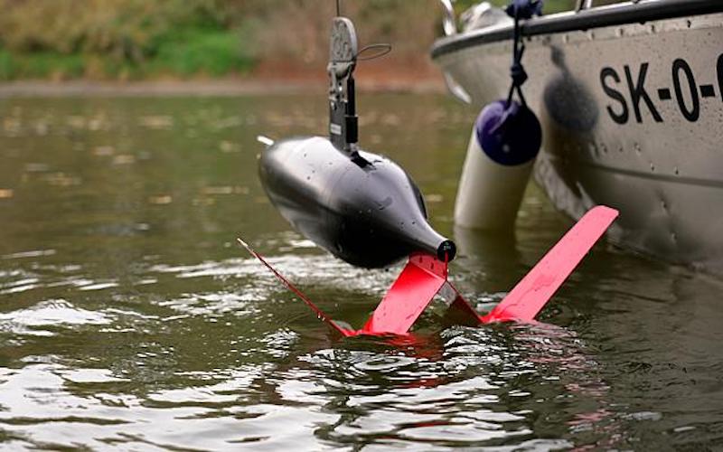
Field surveying is linked to specific tasks and projects that are related to surface-water and groundwater quality monitoring, the restoration of river processes, the morphological evolution of rivers and reservoirs, flow dynamics and flow regimes (for hydrological extremes: floods and droughts) and groundwater regime in relation to various types of anthropogenic impacts. In terms of river and reservoir morphology, field surveying focuses primarily on river channel and floodplain topography, and related physical processes. Field surveys, measurements and observations are also carried out within the scope of long-term, comprehensive monitoring programmes, including specifically targeted groundwater and surface-water monitoring. For these purposes, the most advanced equipment and technologies are applied, including remote data transmission.
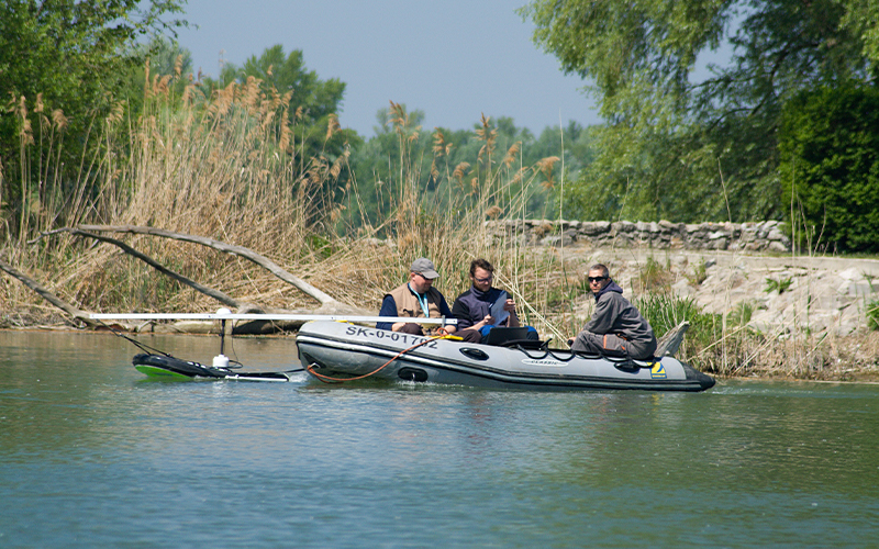
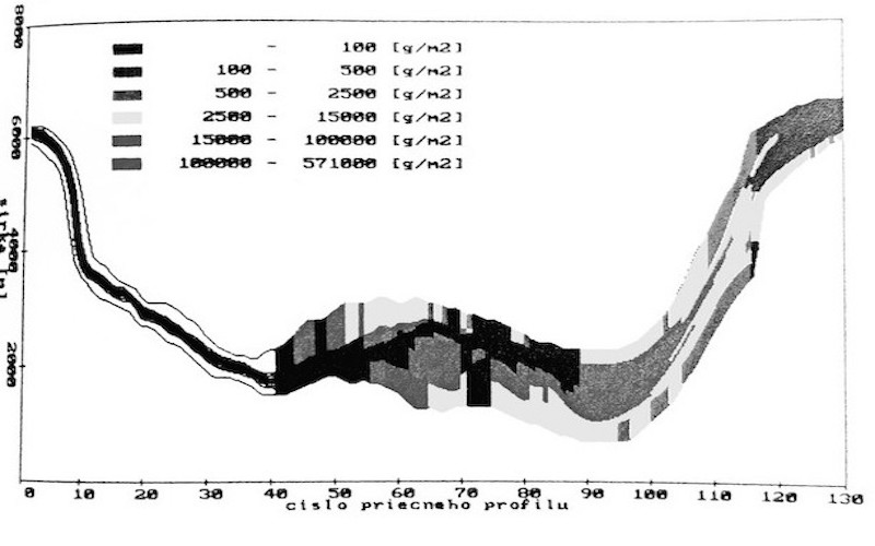
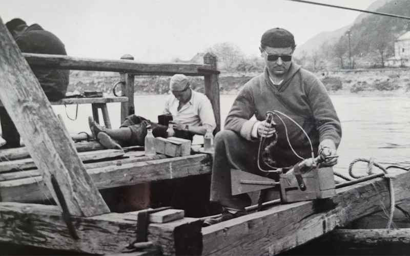
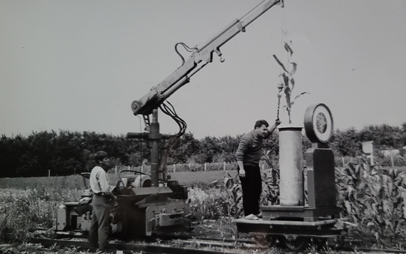
The investigation of sediment transport is based on the results of research carried out in the Danube channel in the 1950s and 1960s, using bedload and suspended-load discharge measurements. In the late 1990s and in the 2006–2008 period, a series of bedload discharge measurements were carried out in the Danube and Morava rivers using Swiss- and modified Helley Smith-bedload samplers, including a series of cross-sectional suspended-load discharge measurements. The Danube’s suspended sediment regime is currently monitored using a traditional integrated sampling method (at Lanfranconi bridge), as well as a progressive method using a laser equipment installed in automated stations (with continual data recording), which are part of the international network of observation stations along the Danube.